
One warning runs from midnight tonight until 5pm on Friday 23 October, with gusts of 50-60 mph. A second, which also covers Medway, runs from 10am to 9pm on Friday.
Kent is now covered by two Met Office yellow warnings for wind as Storm Austen moves in overnight. Strong winds are expected through most of Friday 23 October.
Kent was not included when the first warning was issued. At 9.41am on Wednesday 21 October the Met Office extended the warning “along the Kent coast” and raised the likelihood of significant impacts to medium. At 10am today (Thursday 22 October) it extended the warning’s end time to 5pm on Friday. At 10.03am it issued a second yellow wind warning for Friday daytime, which covers Kent and Medway and much of England.
The two warnings for Kent
- First warning: midnight tonight to 5pm Friday. It covers Kent, but not Medway. The Met Office headline says Storm Austen will bring “a spell of strong winds with transport disruption likely and possible damaging winds in some areas”. It rates the likelihood as medium and the impact as significant.
- Second warning: 10am to 9pm Friday. It covers Kent and Medway, as well as Greater London, Surrey, Sussex, Essex and areas as far north as Yorkshire. The Met Office headline is “a spell of strong winds, touching gales at times, associated with Storm Austen may bring some localised impacts”. It rates the likelihood as high and the impact as moderate.
When and how strong
According to the Met Office, a spell of southerly winds gusting at 50-60 mph will move east along the south coast of England during Thursday night. Strong west to northwesterly winds will then spread across southern England and Wales into Friday.
- Overnight and Friday morning: gusts of 50-60 mph are likely, and some coastal or exposed spots could see 70 mph or more. The Met Office says the strongest gusts are more likely over parts of south-west England.
- Friday daytime: the second warning says inland gales are possible, with gusts of around 45 to 55 mph. These winds are not expected to be as strong as those further south and west.
- Rain and trees: the strong winds will come with periods of heavy rain. The Met Office says many trees are still in full leaf, which adds to the risk of power cuts and travel disruption.
- How long: the first warning ends at 5pm and the second at 9pm on Friday
What the Met Office says to expect
- Road, rail, air and ferry services may be affected, with longer journeys and possible cancellations
- Some roads and bridges may close, and high-sided vehicles are likely to be delayed on exposed routes and bridges
- Power cuts may happen, and could also affect other services such as mobile phone coverage
- Some damage to buildings, such as tiles blown from roofs, could happen
- Flying debris could cause injuries and danger to life
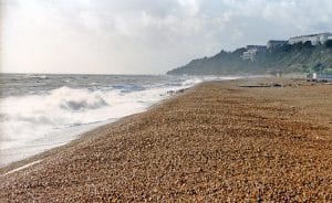
- Some coastal routes, sea fronts and coastal communities are likely to be affected by spray or large waves
- Large waves, and shingle or other beach material thrown onto sea fronts, coastal roads and properties, could cause injuries and danger to life
Because the Met Office extended the first warning specifically along the Kent coast, the coastal advice below is especially relevant to Kent’s seaside towns.
How to prepare
The Met Office’s advice for the warning period:
- Secure loose items this evening. Bins, garden furniture, trampolines, tents, sheds and fences are all named in the warning.
- Check before you travel. Look at road conditions and bus, train and ferry timetables, and change your plans if needed. Live updates: National Highways, Southeastern and the Port of Dover.
- Be ready for a power cut. Have torches, batteries and a charged mobile phone power pack to hand. In Kent, power cuts can be reported to UK Power Networks or by calling 105.
- Take care on the coast. Even from the shore, large breaking waves can sweep people off their feet and out to sea. Take care if walking near cliffs, know your route, and keep dogs on a lead. In a coastal emergency, call 999 and ask for the Coastguard.
- If you must drive, slow down, watch for high-sided vehicles on exposed stretches, and give cyclists, motorcyclists, lorries and buses more room than usual.
Amber warning further west
The Met Office has also issued a more severe amber wind warning for Cornwall, Devon, Plymouth and the Isles of Scilly, from 1am to 10am on Friday. There, gusts of 60-70 mph could develop widely, with around 80 mph possible on exposed headlands. Kent is not in the amber area.
The Met Office has changed these warnings twice since Wednesday and says warnings can change at short notice. Kent Local News will update this article if the warnings for Kent change.